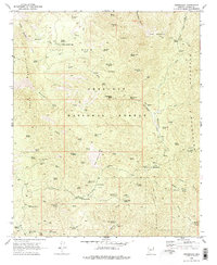
1969 Map of Minnehaha
USGS Topo · Published 1978About this map
The Bradshaw Mountains define the high country of this 1969 survey, where the legacy of Arizona mining is written across the terrain. Within the Prescott National Forest, the landscape is dotted with hard-rock evidence, from the Camp Bird Mine and Button Mine to the Chilean Mill located near Wheels Canyon. The small settlement at Minnehaha and the Indian Springs Camp serve as the primary human hubs in an area otherwise characterized by springs and steep drainages like Maidenhead Canyon.
Find a feature on this map
121 named features on this map. Tap any name to fly to it.
Don’t see what you’re looking for? This feature index may not catch every label — zoom into the map to look around manually.
Map Details
Editions of this 1969 Minnehaha Map
Other maps of this area

1887 · Prescott
USGS Topo · 1:250,000

1892 · Prescott
USGS Topo · 1:250,000

1903 · Bradshaw Mountains
USGS Topo · 1:125,000

1903 · Congress
USGS Topo · 1:125,000

1904 · Congress
USGS Topo · 1:125,000

1947 · Crown King
USGS Topo · 1:62,500

1947 · Mt. Union
USGS Topo · 1:62,500

1947 · Kirkland
USGS Topo · 1:62,500

1947 · Wagoner
USGS Topo · 1:62,500

1948 · Crown King
USGS Topo · 1:63,360