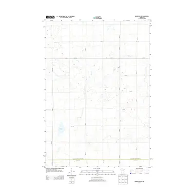
2013 Map of Minneota NW
USGS Topo · Published 2013About this map
The agricultural landscape of the Minnesota prairie is defined here by the border between Yellow Medicine and Lyon Counties, where a rigid grid of section roads structures the rural environment. Small markers of local heritage persist in this open terrain, specifically Swede Home Cem and Israels Cem, which represent the early immigrant lineages that settled the region. These burial grounds are situated along the north-south axis of 370th St, providing a focused window into the genealogical history of the area.
Find a feature on this map
19 named features on this map. Tap any name to fly to it.
Don’t see what you’re looking for? This feature index may not catch every label — zoom into the map to look around manually.
Map Details
Editions of this 2013 Minneota NW Map
This is the sole edition of this map. No revisions or reprints were ever made.
Other maps of this area

1953 · Watertown
USGS Topo · 1:250,000

1953 · New Ulm
USGS Topo · 1:250,000

1957 · New Ulm
USGS Topo · 1:250,000

1958 · New Ulm
USGS Topo · 1:250,000

1958 · Watertown
USGS Topo · 1:250,000

1965 · Clarkfield
USGS Topo · 1:24,000

1965 · Boyd
USGS Topo · 1:24,000

1967 · New Ulm
USGS Topo · 1:250,000

1967 · Minneota
USGS Topo · 1:24,000
1967 · Green Valley
USGS Topo · 1:24,000