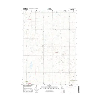
2016 Map of Minneota NW
USGS Topo · Published 2016About this map
The agricultural landscape of Southwest Minnesota is clearly defined by the border between Yellow Medicine Co and Lyon Co, where a strictly organized section-line road network governs the prairie terrain. This survey reflects a deeply established farming tradition, with small cemeteries like Israels Cem and Swede Home Cem serving as quiet focal points for local genealogy and regional history. The topography is subtle, marked by the winding path of Spring Cr and the waters of Burton Lake, which represent the primary natural interruptions to the vast grid of township and range lines. The prevalence of named avenues and streets, such as Co Hwy 10 and 350th St, illustrates the modern connectivity of these rural townships in the early 21st century.
Find a feature on this map
33 named features on this map. Tap any name to fly to it.
Don’t see what you’re looking for? This feature index may not catch every label — zoom into the map to look around manually.
Map Details
Editions of this 2016 Minneota NW Map
This is the sole edition of this map. No revisions or reprints were ever made.
Other maps of this area

1953 · Watertown
USGS Topo · 1:250,000

1953 · New Ulm
USGS Topo · 1:250,000

1957 · New Ulm
USGS Topo · 1:250,000

1958 · New Ulm
USGS Topo · 1:250,000

1958 · Watertown
USGS Topo · 1:250,000

1965 · Clarkfield
USGS Topo · 1:24,000

1965 · Boyd
USGS Topo · 1:24,000

1967 · New Ulm
USGS Topo · 1:250,000

1967 · Minneota
USGS Topo · 1:24,000
1967 · Green Valley
USGS Topo · 1:24,000