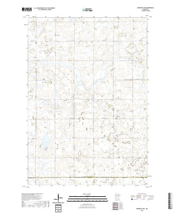
2022 Map of Minneota NW
USGS Topo · Published 2022About this map
The agricultural landscape of Yellow Medicine County is defined by a dense grid of rural roads and the intermittent presence of prairie wetlands. Israels Cem and Swede Home Cem stand as enduring markers of the region's Scandinavian and early pioneer settlement history, situated amidst the township lines of T115N R42W and T114N R42W. The terrain is relatively flat, drained by the meandering Spring Cr, which flows eastward toward the county boundary. Burton Lake provides a rare open water feature in the southwest, surrounded by numerous smaller depressions and seasonal marshes that characterize this part of the Minnesota prairie. The map provides a precise view of the section lines and local infrastructure, including Co RD 32 and Co HWY 3, which facilitate the movement of goods across the Yellow Medicine County and Lyon County line.
Find a feature on this map
24 named features on this map. Tap any name to fly to it.
Don’t see what you’re looking for? This feature index may not catch every label — zoom into the map to look around manually.
Map Details
Editions of this 2022 Minneota NW Map
This is the sole edition of this map. No revisions or reprints were ever made.
Other maps of this area

1953 · Watertown
USGS Topo · 1:250,000

1953 · New Ulm
USGS Topo · 1:250,000

1957 · New Ulm
USGS Topo · 1:250,000

1958 · New Ulm
USGS Topo · 1:250,000

1958 · Watertown
USGS Topo · 1:250,000

1965 · Clarkfield
USGS Topo · 1:24,000

1965 · Boyd
USGS Topo · 1:24,000

1967 · New Ulm
USGS Topo · 1:250,000

1967 · Minneota
USGS Topo · 1:24,000
1967 · Green Valley
USGS Topo · 1:24,000