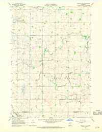
1967 Map of Minneota NW
USGS Topo · Published 1968About this map
Swede Prairie and the surrounding townships of Omro, Tyro, and Burton are defined by a sophisticated system of agricultural drainage that transformed this portion of the Minnesota prairie. The landscape is etched with numerous water management features such as County Ditch No 48 and Judicial Ditch No 20, which channel water toward natural runs like Spring Creek and Mud Creek. These modifications reflect the area's intensive agricultural heritage during the mid-1960s.
Find a feature on this map
21 named features on this map. Tap any name to fly to it.
Don’t see what you’re looking for? This feature index may not catch every label — zoom into the map to look around manually.
Map Details
Editions of this 1967 Minneota NW Map
This is the sole edition of this map. No revisions or reprints were ever made.
Other maps of this area

1953 · Watertown
USGS Topo · 1:250,000

1953 · New Ulm
USGS Topo · 1:250,000

1957 · New Ulm
USGS Topo · 1:250,000

1958 · New Ulm
USGS Topo · 1:250,000

1958 · Watertown
USGS Topo · 1:250,000

1965 · Clarkfield
USGS Topo · 1:24,000

1965 · Boyd
USGS Topo · 1:24,000

1967 · New Ulm
USGS Topo · 1:250,000

1967 · Minneota
USGS Topo · 1:24,000
1967 · Green Valley
USGS Topo · 1:24,000