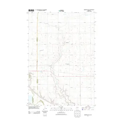
2013 Map of Minnesota Falls
USGS Topo · Published 2013About this map
Minnesota River bottomlands and the winding path of Hawk Cr define the landscape of this southwestern Minnesota region, where the borders of Chippewa, Renville, and Yellow Medicine counties converge. The terrain is characterized by a dense grid of agricultural section roads, such as 888th Ave and 110th St SE, which support a rural economy centered on the fertile prairie above the river bluffs.
Find a feature on this map
26 named features on this map. Tap any name to fly to it.
Don’t see what you’re looking for? This feature index may not catch every label — zoom into the map to look around manually.
Map Details
Editions of this 2013 Minnesota Falls Map
This is the sole edition of this map. No revisions or reprints were ever made.
Other maps of this area

1953 · New Ulm
USGS Topo · 1:250,000

1957 · New Ulm
USGS Topo · 1:250,000

1958 · New Ulm
USGS Topo · 1:250,000

1962 · Wood Lake
USGS Topo · 1:24,000

1965 · Lone Tree Lake
USGS Topo · 1:24,000

1965 · Asbury
USGS Topo · 1:24,000

1965 · Iverson Lake
USGS Topo · 1:24,000
1965 · Maynard
USGS Topo · 1:24,000
1965 · Clara City
USGS Topo · 1:24,000

1965 · Sacred Heart
USGS Topo · 1:24,000
Featured Places
- Granite Falls, MN
- Minnesota Falls, MN
- Renville County, MN
- Yellow Medicine County, MN
- Chippewa County, MN