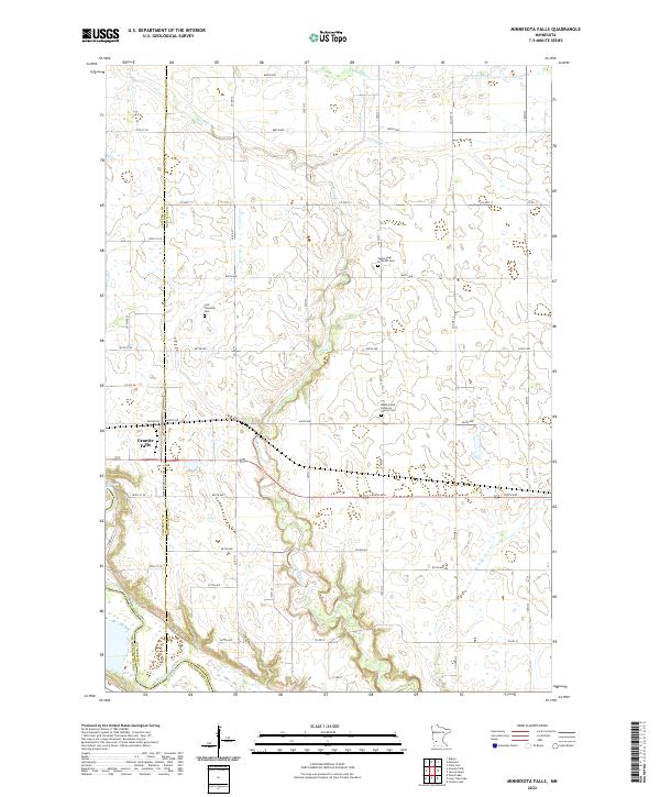
2022 Map of Minnesota Falls
USGS Topo · Published 2022About this map
The Minnesota River flows through the southwestern corner of this survey, defining a landscape marked by the convergence of several significant tributaries including Hawk Cr and Chetomba Cr. The southeastern outskirts of Granite Falls are visible here, where the river serves as a natural boundary between Chippewa and Yellow Medicine counties. The map provides a detailed view of the rural township structure, revealing a network of section roads like 840th Ave and Co Hwy 11 that grid the agricultural uplands north of the river valley.
Find a feature on this map
41 named features on this map. Tap any name to fly to it.
Don’t see what you’re looking for? This feature index may not catch every label — zoom into the map to look around manually.
Map Details
Editions of this 2022 Minnesota Falls Map
This is the sole edition of this map. No revisions or reprints were ever made.
Other maps of this area

1953 · New Ulm
USGS Topo · 1:250,000

1957 · New Ulm
USGS Topo · 1:250,000

1958 · New Ulm
USGS Topo · 1:250,000

1962 · Wood Lake
USGS Topo · 1:24,000

1965 · Lone Tree Lake
USGS Topo · 1:24,000

1965 · Asbury
USGS Topo · 1:24,000

1965 · Iverson Lake
USGS Topo · 1:24,000
1965 · Maynard
USGS Topo · 1:24,000
1965 · Clara City
USGS Topo · 1:24,000

1965 · Sacred Heart
USGS Topo · 1:24,000
Featured Places
- Granite Falls, MN
- Minnesota Falls, MN
- Renville County, MN
- Yellow Medicine County, MN
- Chippewa County, MN