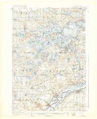
1907 Map of Minnetonka
USGS Topo · Published 1932About this map
The complex shoreline of Lake Minnetonka dominates the center of this early 20th-century landscape, characterized by numerous bays, islands, and narrow channels. Detailed bathymetry and shoreline surveys conducted by the U.S. Army Engineers reveal a developed lakefront economy with an established Steamboat Route connecting points like Wayzata and Excelsior. Residential and seasonal clusters such as Ferndale, Orono, and Spring Park are visible, while the southern portion of the sheet transitions into the agricultural terrain of Laketown and Chanhassen.
Find a feature on this map
128 named features on this map. Tap any name to fly to it.
Don’t see what you’re looking for? This feature index may not catch every label — zoom into the map to look around manually.
Map Details
Editions of this 1907 Minnetonka Map
3 editions found
Other maps of this area

1896 · Minneapolis
USGS Topo · 1:62,500

1901 · Minneapolis
USGS Topo · 1:62,500

1902 · Anoka
USGS Topo · 1:62,500

1905 · Minnetonka
USGS Topo · 1:62,500

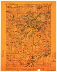
1907 · Minnetonka
USGS Topo · 1:62,500

1909 · Rockford
USGS Topo · 1:62,500

1953 · Saint Paul
USGS Topo · 1:250,000

1953 · Stillwater
USGS Topo · 1:250,000

1954 · Hopkins
USGS Topo · 1:24,000

1954 · Eden Prairie
USGS Topo · 1:24,000