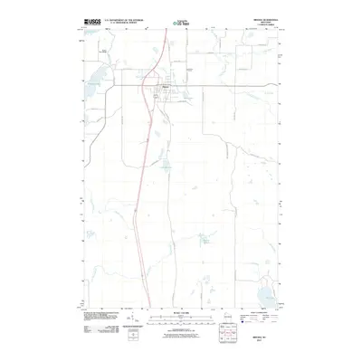
2010 Map of Minong
USGS Topo · Published 2010About this map
Minong serves as the central hub of this northern Wisconsin landscape, situated at the junction of modern transit corridors and traditional county routes like County Hwy I. The town is surrounded by a dense network of water bodies and marshy tributaries, including Shell Creek to the north and the winding Stuntz Brook to the south. Notable for its glacial geography, the area features numerous named lakes such as Pokegama Lake, Bond Lake, and Gull Lake in the southeast corner. These water resources, managed in part by structures like the Fischer Dam WP380 on Rice Lake 2, define the local topography. Local history and genealogy are anchored at the Greenwood Cemetery, located east of the main settlement near Bear Tree Rd. The map also details a sprawling system of forest and rural roads, such as Gardner Lake Forest Rd, which navigate the wetlands and creeks that feed into the larger regional basins.
Find a feature on this map
37 named features on this map. Tap any name to fly to it.
Don’t see what you’re looking for? This feature index may not catch every label — zoom into the map to look around manually.
Map Details
Editions of this 2010 Minong Map
This is the sole edition of this map. No revisions or reprints were ever made.
Other maps of this area

1947 · Chittamo
USGS Topo · 1:48,000

1947 · Minong
USGS Topo · 1:48,000

1948 · Spooner
USGS Topo · 1:48,000

1948 · Stone Lake
USGS Topo · 1:48,000

1949 · Chittamo
USGS Topo · 1:48,000

1949 · Minong
USGS Topo · 1:48,000

1949 · Spooner
USGS Topo · 1:48,000

1950 · Stone Lake
USGS Topo · 1:48,000

1953 · Ashland
USGS Topo · 1:250,000

1953 · Rice Lake
USGS Topo · 1:250,000