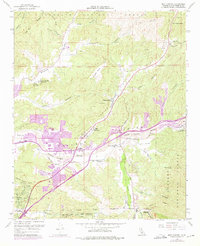
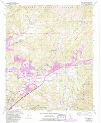
1960 Map of Mint Canyon
USGS Topo · Published 1975About this map
The Santa Clara River and the Southern Pacific railroad corridor dictate the settlement patterns of this northern Los Angeles County landscape. In the mid-1970s, purple revision layers reveal a period of rapid suburban expansion near Honby and Solemint, while the surrounding geography remains dominated by the steep canyons of the Angeles National Forest. Notable institutional sites like the Joe Scott Boys Camp and Kenyon Scudder Boys Camp are tucked into the drainages of Plum Canyon and Bouquet Canyon.
Find a feature on this map
43 named features on this map. Tap any name to fly to it.
Don’t see what you’re looking for? This feature index may not catch every label — zoom into the map to look around manually.
Map Details
Editions of this 1960 Mint Canyon Map
5 editions found
Other maps of this area

1900 · Fernando
USGS Topo · 1:62,500

1901 · Southern California Sheet No. 1
USGS Topo · 1:250,000

1903 · Tejon
USGS Topo · 1:125,000

1903 · Camulos
USGS Topo · 1:125,000

1903 · Santa Susana
USGS Topo · 1:62,500

1904 · Southern California Sheet No. 1
USGS Topo · 1:250,000

1915 · Elizabeth Lake
USGS Topo · 1:125,000

1917 · Elizabeth Lake
USGS Topo · 1:125,000

1925 · Sylmar
USGS Topo · 1:24,000

1928 · Sylmar
USGS Topo · 1:24,000