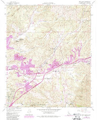
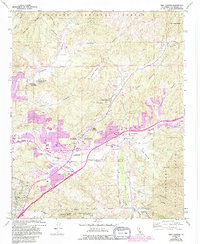
1960 Map of Mint Canyon
USGS Topo · Published 1988About this map
The Santa Clara River corridor serves as the primary axis for development and transport in this 1960s study, later updated to show the encroaching suburban footprint of the Santa Clarita Valley. Small communities such as Honby, Solemint, and Humphreys dot the valley floor, while the Antelope Valley Freeway begins to reshape the landscape alongside the historic Southern Pacific rail line. To the north, the terrain transitions into the steep ridges of the Angeles National Forest, where canyon names like Vasquez Canyon, Bouquet Canyon, and Mint Canyon hint at the area's geological and ranching history.
Find a feature on this map
40 named features on this map. Tap any name to fly to it.
Don’t see what you’re looking for? This feature index may not catch every label — zoom into the map to look around manually.
Map Details
Editions of this 1960 Mint Canyon Map
5 editions found
Other maps of this area

1900 · Fernando
USGS Topo · 1:62,500

1901 · Southern California Sheet No. 1
USGS Topo · 1:250,000

1903 · Tejon
USGS Topo · 1:125,000

1903 · Camulos
USGS Topo · 1:125,000

1903 · Santa Susana
USGS Topo · 1:62,500

1904 · Southern California Sheet No. 1
USGS Topo · 1:250,000

1915 · Elizabeth Lake
USGS Topo · 1:125,000

1917 · Elizabeth Lake
USGS Topo · 1:125,000

1925 · Sylmar
USGS Topo · 1:24,000

1928 · Sylmar
USGS Topo · 1:24,000