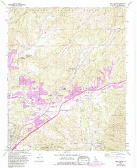
1960 Map of Mint Canyon
USGS Topo · Published 1994About this map
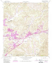
Solemint and Honby sit at the western edge of this landscape where the Santa Clara River valley meets the rising terrain of the Angeles National Forest. By the early 1990s, the purple tint of urbanization highlights the rapid expansion of Santa Clarita, showing how residential development began to push into canyons like Plum Canyon and Sand Canyon. The transportation corridor is a central theme, with the Southern Pacific tracks and an Old Railroad Grade running parallel to the modern Antelope Valley Freeway and Sierra Highway. Away from the valley floor, the map preserves rural and specialized landmarks such as the Sulphur Spring Sch, Kenyon Scudder Boys Camp, and the isolated outpost of Forest Park nestled beneath Cruzan Mesa.
Find a feature on this map
39 named features on this map. Tap any name to fly to it.
Don’t see what you’re looking for? This feature index may not catch every label — zoom into the map to look around manually.
Map Details
Editions of this 1960 Mint Canyon Map
5 editions found
Other maps of this area

1900 · Fernando
USGS Topo · 1:62,500

1901 · Southern California Sheet No. 1
USGS Topo · 1:250,000

1903 · Tejon
USGS Topo · 1:125,000

1903 · Camulos
USGS Topo · 1:125,000

1903 · Santa Susana
USGS Topo · 1:62,500

1904 · Southern California Sheet No. 1
USGS Topo · 1:250,000

1915 · Elizabeth Lake
USGS Topo · 1:125,000

1917 · Elizabeth Lake
USGS Topo · 1:125,000

1925 · Sylmar
USGS Topo · 1:24,000

1928 · Sylmar
USGS Topo · 1:24,000