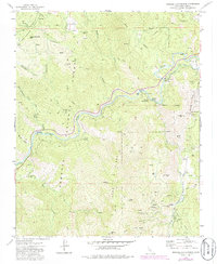
1972 Map of Miracle Hot Springs
USGS Topo · Published 1986About this map
Havilah serves as a historic focal point within the Sequoia National Forest, appearing here as it was documented in the early 1970s and revised in the mid-1980s. This region of the Greenhorn Mountains is defined by a legacy of resource extraction and thermal springs. The Kern River carves through the center of the sheet, paralleled by the Borel Canal and supporting the Borel Powerhouse. The mapping captures a high concentration of lode mining activity along the eastern canyons, particularly near Havilah, where the Southern Cross Mine, Friday Mine, and Uncle Sam Mine are located.
Find a feature on this map
57 named features on this map. Tap any name to fly to it.
Don’t see what you’re looking for? This feature index may not catch every label — zoom into the map to look around manually.
Map Details
Editions of this 1972 Miracle Hot Springs Map
3 editions found
Other maps of this area

1906 · Kernville
USGS Topo · 1:125,000

1908 · Kernville
USGS Topo · 1:125,000

1914 · Caliente
USGS Topo · 1:125,000

1915 · Mojave
USGS Topo · 1:125,000

1920 · Delonagha
USGS Topo · 1:62,500

1926 · Glennville
USGS Topo · 1:62,500

1936 · Tobias Peak
USGS Topo · 1:125,000

1943 · Emerald Mtn
USGS Topo · 1:62,500

1943 · Breckenridge Mountain
USGS Topo · 1:62,500

1943 · Tobias Peak
USGS Topo · 1:125,000