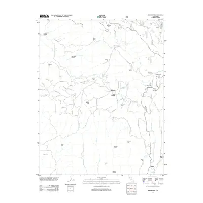
2012 Map of Miramonte
USGS Topo · Published 2012About this map
Miramonte and the high mountain communities of eastern Fresno County are centered here in the Sierra Nevada foothills. The map reveals a landscape defined by deep canyons and scattered ranching outposts, where Stillwell Ranch and Wildwood Farm occupy the lower western reaches. As the elevation climbs toward Mitchell Peak, the settlement pattern shifts to clustered mountain retreats and historic stops like Pinehurst, Cedarbrook, and Etheda Springs. This 2012 survey illustrates the modern road network, including the winding E Kings Canyon Rd and Badger-Miramonte road, which link these communities. Resource management and recreation are evident through the Miramonte Conservation Camp and the presence of Cedarbrook Picnic Area and Neffs Camp, highlighting the area's role as a gateway to the high sierra.
Find a feature on this map
70 named features on this map. Tap any name to fly to it.
Don’t see what you’re looking for? This feature index may not catch every label — zoom into the map to look around manually.
Map Details
Editions of this 2012 Miramonte Map
This is the sole edition of this map. No revisions or reprints were ever made.
Other maps of this area

1903 · Tehipite
USGS Topo · 1:125,000

1905 · Tehipite
USGS Topo · 1:125,000

1921 · Stokes Mountain
USGS Topo · 1:24,000

1922 · Trimmer
USGS Topo · 1:96,000

1924 · Dinuba
USGS Topo · 1:125,000

1924 · Stokes Mountain
USGS Topo · 1:31,680

1942 · Dunlap
USGS Topo · 1:62,500

1944 · Dunlap
USGS Topo · 1:62,500

1948 · Fresno
USGS Topo · 1:250,000

1952 · Tehipite Dome
USGS Topo · 1:62,500