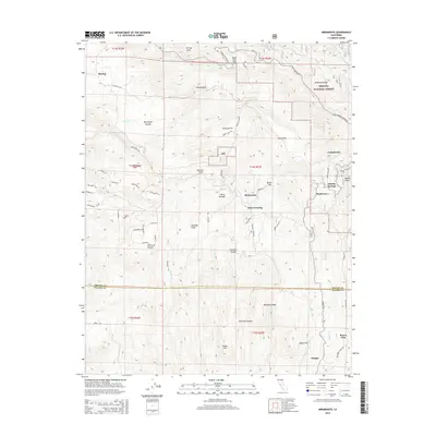
2015 Map of Miramonte
USGS Topo · Published 2015About this map
Sequoia National Forest dominates the northeastern reaches of this landscape where the Sierra Nevada rises above the foothills. The boundary between Fresno and Tulare counties cuts horizontally across the map, separating the northern settlements of Pinehurst and Miramonte from the southern community of Badger. This area reflects a complex network of forest roads and rural residential lanes, such as Lullaby Ln and Chuckwagon Rd, illustrating the modern development of these foothill communities. The terrain is marked by significant geographic landmarks like Whale Rock, Mitchell Peak, and Sontag Point, while the presence of Etheda Springs and numerous flats like Johnson Flat and Burns Flat suggests a history of seasonal habitation and resource use. Waterways including Mill Creek and Badger Creek drain the canyons, supporting small clusters of homes and logging-related sites like Logger Point.
Find a feature on this map
72 named features on this map. Tap any name to fly to it.
Don’t see what you’re looking for? This feature index may not catch every label — zoom into the map to look around manually.
Map Details
Editions of this 2015 Miramonte Map
This is the sole edition of this map. No revisions or reprints were ever made.
Other maps of this area

1903 · Tehipite
USGS Topo · 1:125,000

1905 · Tehipite
USGS Topo · 1:125,000

1921 · Stokes Mountain
USGS Topo · 1:24,000

1922 · Trimmer
USGS Topo · 1:96,000

1924 · Dinuba
USGS Topo · 1:125,000

1924 · Stokes Mountain
USGS Topo · 1:31,680

1942 · Dunlap
USGS Topo · 1:62,500

1944 · Dunlap
USGS Topo · 1:62,500

1948 · Fresno
USGS Topo · 1:250,000

1952 · Tehipite Dome
USGS Topo · 1:62,500