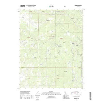
2018 Map of Miramonte
USGS Topo · Published 2018About this map
Sequoia National Forest dominates the eastern half of this terrain, where the foothills of the Sierra Nevada begin their ascent. The landscape is defined by a dense network of canyons and flats, such as Milk Ranch Canyon and Johnson Flat, which historically served as vital access points for timber and ranching. Small mountain communities like Miramonte and Pinehurst are situated along the winding paths of Dunlap Rd and E Kings Canyon Rd, reflecting the scattered settlement patterns of eastern Fresno County. The transition across the Fresno and Tulare county line reveals a geography rich in local nomenclature, from Whale Rock to Wild Hog Canyon. This area, documented in 2018, shows the modern road network weaving through traditional land divisions, including Badger and the high-elevation reach of McKenzie Ridge.
Find a feature on this map
84 named features on this map. Tap any name to fly to it.
Don’t see what you’re looking for? This feature index may not catch every label — zoom into the map to look around manually.
Map Details
Editions of this 2018 Miramonte Map
This is the sole edition of this map. No revisions or reprints were ever made.
Other maps of this area

1903 · Tehipite
USGS Topo · 1:125,000

1905 · Tehipite
USGS Topo · 1:125,000

1921 · Stokes Mountain
USGS Topo · 1:24,000

1922 · Trimmer
USGS Topo · 1:96,000

1924 · Dinuba
USGS Topo · 1:125,000

1924 · Stokes Mountain
USGS Topo · 1:31,680

1942 · Dunlap
USGS Topo · 1:62,500

1944 · Dunlap
USGS Topo · 1:62,500

1948 · Fresno
USGS Topo · 1:250,000

1952 · Tehipite Dome
USGS Topo · 1:62,500