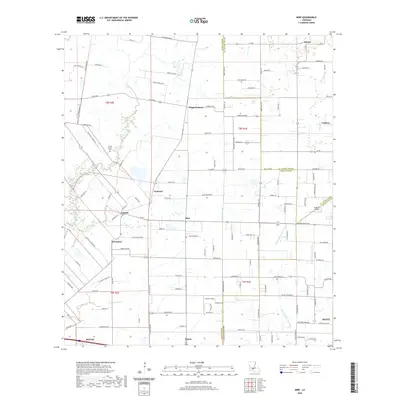
2020 Map of Mire
USGS Topo · Published 2020About this map
The lowlands of southwestern Louisiana at the intersection of Acadia, St. Landry, and Lafayette Parishes define this detailed study of the rural landscape. Small, traditionally established communities such as Mire, Arceneaux, and Higginbotham are situated amidst a network of drainage ways and bayous, including Bayou Queue de Tortue and Coulee Duralde. These watercourses have historically shaped the agricultural boundaries and transportation routes of the region.
Find a feature on this map
122 named features on this map. Tap any name to fly to it.
Don’t see what you’re looking for? This feature index may not catch every label — zoom into the map to look around manually.
Map Details
Editions of this 2020 Mire Map
This is the sole edition of this map. No revisions or reprints were ever made.
Other maps of this area

1934 · Duson
USGS Topo · 1:31,680

1935 · Branch
USGS Topo · 1:31,680

1946 · Lafayette
USGS Topo · 1:31,680

1946 · Rayne
USGS Topo · 1:31,680

1947 · Branch
USGS Topo · 1:31,680

1947 · Pitreville
USGS Topo · 1:31,680

1952 · Lake Charles
USGS Topo · 1:250,000

1954 · Lafayette
USGS Topo · 1:31,680

1954 · Duson
USGS Topo · 1:31,680
1954 · Rayne
USGS Topo · 1:31,680