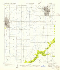
1954 Map of Rayne
USGS Topo · Published 1954About this map
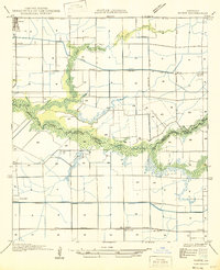
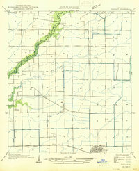
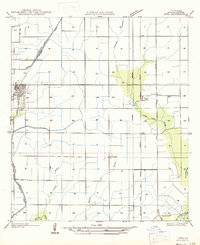
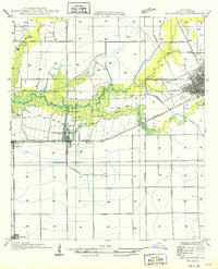
The intersection of agriculture and heavy rail dominates this landscape between Rayne and Crowley, situated in the heart of Louisiana's prairie region. The survey reveals a meticulously partitioned territory where an extensive network of irrigation ditches and canals, including the Roller Canal, supports the local rice-growing economy. Dual rail lines, the Southern Pacific and Texas and Pacific, parallel each other across the northern half of the map, anchoring the commercial growth of these Acadia Parish hubs.
Find a feature on this map
27 named features on this map. Tap any name to fly to it.
Don’t see what you’re looking for? This feature index may not catch every label — zoom into the map to look around manually.
Map Details
Editions of this 1954 Rayne Map
This is the sole edition of this map. No revisions or reprints were ever made.
Other maps of this area

1934 · Duson
USGS Topo · 1:31,680

1935 · Branch
USGS Topo · 1:31,680
1946 · Morse
USGS Topo · 1:31,680

1946 · Leroy
USGS Topo · 1:31,680
1946 · Kaplan
USGS Topo · 1:31,680

1946 · Rayne
USGS Topo · 1:31,680

1947 · Branch
USGS Topo · 1:31,680
1947 · Iota
USGS Topo · 1:31,680
1949 · Estherwood
USGS Topo · 1:31,680

1952 · Lake Charles
USGS Topo · 1:250,000