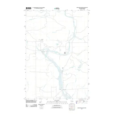
2011 Map of Miscauno Island
USGS Topo · Published 2011About this map
The Menominee River serves as the central artery and natural boundary for this borderland between Wisconsin and Michigan, defining the landscape with its significant islands and hydroelectric infrastructure. At the heart of the map lies Miscauno Island, a prominent landmass surrounded by the river's split channels. Further south, the river is harnessed at the Chalk Hill Dam and the nearby Chalk Hill Bridge, which marks a critical crossing point for the region. The settlement of White Pine Haven is positioned near the riverbank, suggesting a community tied closely to the water.
Find a feature on this map
23 named features on this map. Tap any name to fly to it.
Don’t see what you’re looking for? This feature index may not catch every label — zoom into the map to look around manually.
Map Details
Editions of this 2011 Miscauno Island Map
This is the sole edition of this map. No revisions or reprints were ever made.
Other maps of this area

1939 · Pembine
USGS Topo · 1:48,000

1942 · Wausaukee
USGS Topo · 1:48,000

1947 · Pembine
USGS Topo · 1:48,000

1947 · Wausaukee
USGS Topo · 1:48,000

1949 · Stephenson
USGS Topo · 1:48,000

1954 · Escanaba
USGS Topo · 1:250,000

1957 · Escanaba
USGS Topo · 1:250,000

1958 · Escanaba
USGS Topo · 1:250,000

1963 · Pembine
USGS Topo · 1:62,500

1963 · Powers
USGS Topo · 1:62,500