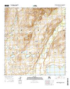
2015 Map of Misheguk Mountain A-5 SW
USGS Topo · Published 2015About this map
Noatak National Preserve encompasses the vast majority of this landscape, where the Augun River and Kugururok River flow through an environment shaped by glacial history and arctic hydrology. The water system is punctuated by Lake Narvakrak in the southeast, situated within a topography defined by significant elevation changes and traditional township and range divisions. The absence of modern infrastructure or permanent settlements reflects the protected status of this wilderness area in the early 21st century. This map documents a specialized arctic ecosystem where drainage patterns and localized water bodies dictate the character of the terrain, providing a look at a remote part of the Northwest Arctic Borough before subsequent environmental shifts.
Find a feature on this map
12 named features on this map. Tap any name to fly to it.
Don’t see what you’re looking for? This feature index may not catch every label — zoom into the map to look around manually.
Map Details
Editions of this 2015 Misheguk Mountain A-5 SW Map
This is the sole edition of this map. No revisions or reprints were ever made.
Other maps of this area

1951 · De Long Mountains
USGS Topo · 1:250,000

1951 · Baird Mountains
USGS Topo · 1:250,000

1951 · Noatak
USGS Topo · 1:250,000

1951 · Misheguk Mountain
USGS Topo · 1:250,000

1955 · Noatak
USGS Topo · 1:250,000

1955 · De Long Mountains
USGS Topo · 1:250,000

1955 · Noatak D-1
USGS Topo · 1:63,360

1955 · Baird Mountains D-6
USGS Topo · 1:63,360

1955 · Misheguk Mountain A-5
USGS Topo · 1:63,360

1955 · De Long Mountains A-1
USGS Topo · 1:63,360