
1955 Map of Baird Mountains D-6
USGS Topo · Published 1965About this map
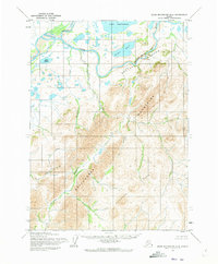
The Noatak River dominates this mid-century landscape of Northwest Arctic, Alaska, as it carves through the formidable Baird Mountains and Maiyumerak Mountains. This 1955 survey reveals a terrain defined by its water systems, where the Kugururok River joins the main flow and several isolated bodies of water like Lake Narvakrak, Lake Tulugak, and Lake Mapsa dot the northern flats. The map illustrates the dramatic passage of the Noatak Canyon, where the river is hemmed in by steep bluffs. Beyond the primary waterways, numerous tributary streams including Kungiakrak Creek, Uvgoon Creek, and Ahalibnak Creek drain the surrounding peaks. Mapped primarily from aerial photographs by the Army Map Service, the sheet reflects an era of intense topographical documentation in the Brooks Range foothills, showing a land without roads or trails where the river provided the primary corridor for movement.
Find a feature on this map
13 named features on this map. Tap any name to fly to it.
Don’t see what you’re looking for? This feature index may not catch every label — zoom into the map to look around manually.
Map Details
Editions of this 1955 Baird Mountains D-6 Map
2 editions found
Other maps of this area

1951 · De Long Mountains
USGS Topo · 1:250,000

1951 · Baird Mountains
USGS Topo · 1:250,000

1951 · Noatak
USGS Topo · 1:250,000

1951 · Misheguk Mountain
USGS Topo · 1:250,000

1955 · Noatak
USGS Topo · 1:250,000

1955 · De Long Mountains
USGS Topo · 1:250,000

1955 · Noatak D-1
USGS Topo · 1:63,360

1955 · Baird Mountains D-5
USGS Topo · 1:63,360

1955 · Misheguk Mountain A-5
USGS Topo · 1:63,360

1955 · De Long Mountains A-1
USGS Topo · 1:63,360