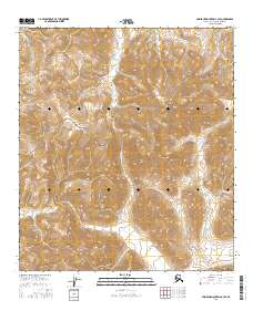
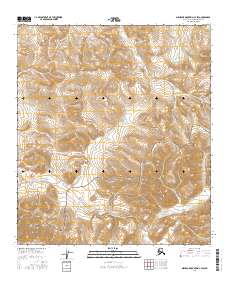
2016 Map of Misheguk Mountain C-3 SE
USGS Topo · Published 2016About this map
The Noatak National Preserve encompasses a significant portion of this high-latitude landscape, where the southern slopes of the De Long Mountains meet a complex network of arctic waterways. This 2016 survey captures the drainage patterns of the western Arctic, anchored by the Nimiuktuk River flowing southward through the eastern reach of the quadrangle. High points like Black Mtn rise above a series of named drainages, including Driftwood Cr, Seagull Cr, and Nucleus Cr, which define the local topography. The absence of roads or permanent settlements underscores the wilderness character of the North Slope Borough, where the land is primarily organized by the Public Land Survey System grids, such as t10s r36w. The map serves as a contemporary record of these remote headwaters before they join the larger Noatak River system.
Find a feature on this map
18 named features on this map. Tap any name to fly to it.
Don’t see what you’re looking for? This feature index may not catch every label — zoom into the map to look around manually.
Map Details
Editions of this 2016 Misheguk Mountain C-3 SE Map
This is the sole edition of this map. No revisions or reprints were ever made.
Other maps of this area

1951 · Misheguk Mountain
USGS Topo · 1:250,000

1956 · Misheguk Mountain
USGS Topo · 1:250,000
1984 · Misheguk Mountain C-2
USGS Topo · 1:63,360
1984 · Misheguk Mountain C-3
USGS Topo · 1:63,360
1990 · Misheguk Mountain B-2
USGS Topo · 1:63,360
1990 · Misheguk Mountain B-3
USGS Topo · 1:63,360
2015 · Misheguk Mountain B-3 NW
USGS Topo · 1:25,000
2015 · Misheguk Mountain B-3 NE
USGS Topo · 1:25,000
2015 · Misheguk Mountain B-2 NW
USGS Topo · 1:25,000
2016 · Misheguk Mountain C-3 SW
USGS Topo · 1:25,000