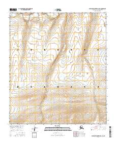
2016 Map of Misheguk Mountain D-2 NE
USGS Topo · Published 2016About this map
The Colville River carves through the northern reaches of the Alaska North Slope in this 2016 survey, representing one of the most remote and untouched landscapes in the United States. This map highlights a region defined by high-latitude drainage patterns and subtle relief, where the river's path is the primary geographical anchor for the vast, unpopulated interior. Surveyed under the modern US Topo standard, the sheet reveals the complex topography of the Misheguk Mountain area, dominated by land divisions such as t5s r33w and t6s r33w. The absence of roads or permanent settlements underscores the wilderness character of the Arctic tundra, where the Colville remains the central artery for seasonal travel and ecological connectivity in this corner of the borough.
Find a feature on this map
7 named features on this map. Tap any name to fly to it.
Don’t see what you’re looking for? This feature index may not catch every label — zoom into the map to look around manually.
Map Details
Editions of this 2016 Misheguk Mountain D-2 NE Map
This is the sole edition of this map. No revisions or reprints were ever made.
Other maps of this area

1951 · Utukok River
USGS Topo · 1:250,000

1951 · Misheguk Mountain
USGS Topo · 1:250,000

1956 · Misheguk Mountain
USGS Topo · 1:250,000

1956 · Utukok River
USGS Topo · 1:250,000

1965 · Utukok River
USGS Topo · 1:250,000
1984 · Misheguk Mountain D-1
USGS Topo · 1:63,360
1984 · Misheguk Mountain D-2
USGS Topo · 1:63,360
1984 · Utukok River A-2
USGS Topo · 1:63,360
1984 · Utukok River A-1
USGS Topo · 1:63,360
2015 · Misheguk Mountain D-1 SW
USGS Topo · 1:25,000