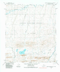
1984 Map of Misheguk Mountain D-2
USGS Topo · Published 1984About this map
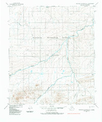
The Colville River flows across the northern reaches of this remote landscape, situated within the expansive National Petroleum Reserve in Alaska. This 1984 survey, based on aerial photography from the mid-1970s, documents a wilderness of braided waterways and high-latitude terrain before modern infrastructure changes. In the southern portion of the quadrangle, Noluck Lake serves as a prominent landmark at the headwaters of Storm Creek. The drainage patterns are defined by the Nuka River and its tributary, Pilly Fork, while the northern section is marked by Kamiktungitak Creek and Paik Creek. A solitary Tractor Trail provides the only evidence of overland transportation, reflecting the logistical challenges of Arctic exploration and land management in this period.
Find a feature on this map
14 named features on this map. Tap any name to fly to it.
Don’t see what you’re looking for? This feature index may not catch every label — zoom into the map to look around manually.
Map Details
Editions of this 1984 Misheguk Mountain D-2 Map
This is the sole edition of this map. No revisions or reprints were ever made.
Other maps of this area

1951 · Utukok River
USGS Topo · 1:250,000

1951 · Misheguk Mountain
USGS Topo · 1:250,000
1955 · Utukok River A-3
USGS Topo · 1:63,360

1956 · Misheguk Mountain
USGS Topo · 1:250,000

1956 · Utukok River
USGS Topo · 1:250,000

1965 · Utukok River
USGS Topo · 1:250,000
1984 · Misheguk Mountain C-1
USGS Topo · 1:63,360
1984 · Misheguk Mountain C-2
USGS Topo · 1:63,360
1984 · Misheguk Mountain D-1
USGS Topo · 1:63,360
1984 · Misheguk Mountain C-3
USGS Topo · 1:63,360