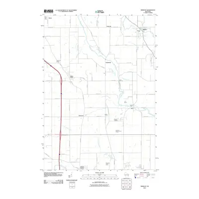
2010 Map of Mishicot
USGS Topo · Published 2010About this map
The West Twin River and East Twin River converge near Mishicot, defining the hydraulic character of this Manitowoc County landscape. While Mishicot serves as a primary hub with its namesake Mishicot Dam, the surrounding rural townships are dotted with smaller settlements like Francis Creek, Rockwood, and Shoto. The map reveals a significant concentration of burial sites, including the Francis Creek National Cemetery, Melnik Presbyterian Cemetery, and the Knollwood Memorial Gardens Cemetery, which provide valuable touchpoints for genealogical research.
Find a feature on this map
71 named features on this map. Tap any name to fly to it.
Don’t see what you’re looking for? This feature index may not catch every label — zoom into the map to look around manually.
Map Details
Editions of this 2010 Mishicot Map
This is the sole edition of this map. No revisions or reprints were ever made.
Other maps of this area

1954 · Kewaunee
USGS Topo · 1:62,500

1954 · Manitowoc
USGS Topo · 1:62,500

1954 · Denmark
USGS Topo · 1:62,500

1954 · Reedsville
USGS Topo · 1:62,500

1954 · Manitowoc
USGS Topo · 1:24,000

1954 · Manitowoc
USGS Topo · 1:250,000

1958 · Manitowoc
USGS Topo · 1:250,000
1978 · Clarks Mills
USGS Topo · 1:24,000

1978 · Denmark
USGS Topo · 1:24,000
1978 · Two Rivers
USGS Topo · 1:24,000