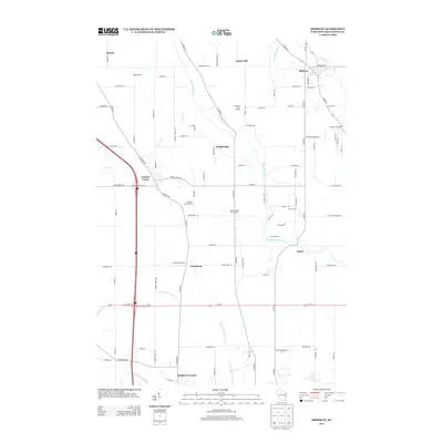
2013 Map of Mishicot
USGS Topo · Published 2013About this map
Mishicot sits at the northern edge of this Wisconsin landscape, where the East Twin River and West Twin River begin their convergence. The area is defined by a dense network of dairy operations and specialized agriculture, including the Meadow Brook Dairy Farms, Indian Springs Dairy Farm, and the Sandy Bay Mink Ranch. The drainage of the Little Manitowoc River and Manitowoc River to the south shapes the placement of smaller crossroads such as Kellners Corners and Rockwood.
Find a feature on this map
98 named features on this map. Tap any name to fly to it.
Don’t see what you’re looking for? This feature index may not catch every label — zoom into the map to look around manually.
Map Details
Editions of this 2013 Mishicot Map
This is the sole edition of this map. No revisions or reprints were ever made.
Other maps of this area

1954 · Kewaunee
USGS Topo · 1:62,500

1954 · Manitowoc
USGS Topo · 1:62,500

1954 · Denmark
USGS Topo · 1:62,500

1954 · Reedsville
USGS Topo · 1:62,500

1954 · Manitowoc
USGS Topo · 1:24,000

1954 · Manitowoc
USGS Topo · 1:250,000

1958 · Manitowoc
USGS Topo · 1:250,000
1978 · Clarks Mills
USGS Topo · 1:24,000

1978 · Denmark
USGS Topo · 1:24,000
1978 · Two Rivers
USGS Topo · 1:24,000