2022 Map of Mishicot
USGS Topo · Published 2022About this map
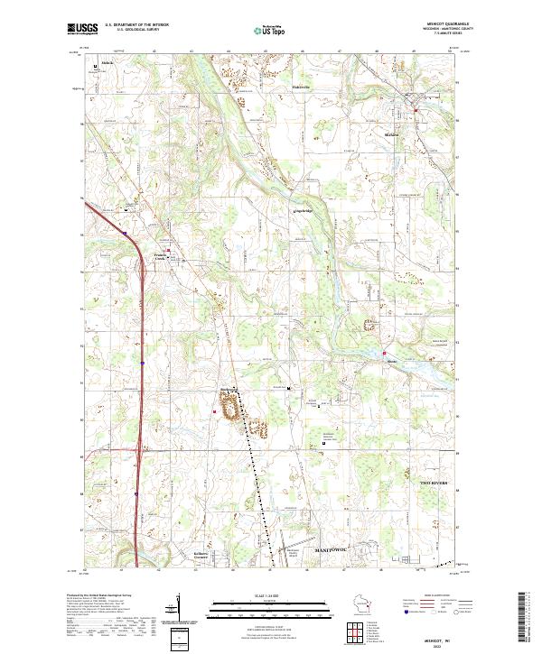
The West Twin River and East Twin River converge near Mishicot in this portion of Manitowoc County, defining a landscape shaped by glacial watercourses and rural industry. The village of Mishicot stands as a primary hub, while smaller historically significant settlements like Francis Creek, Rockwood, Kingsbridge, and Shoto are distributed across the township lines. The mapping of regional cemeteries, such as Melnik Presbyterian Cem and Kossuth Cem Number 1, provides critical coordinates for genealogical research in these long-established farming communities. Modern infrastructure and conservation efforts appear alongside the old, with the Ice Age National Scenic Trl and Devil's River State Trl traversing the terrain. Along the southern edge, the Manitowoc River flows toward Maritime Bay, signaling the transition into the larger industrial and maritime environment of the county seat.
Find a feature on this map
118 named features on this map. Tap any name to fly to it.
Don’t see what you’re looking for? This feature index may not catch every label — zoom into the map to look around manually.
Map Details
Editions of this 2022 Mishicot Map
This is the sole edition of this map. No revisions or reprints were ever made.