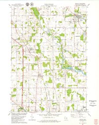
1978 Map of Mishicot
USGS Topo · Published 1979About this map
The West Twin River and East Twin River systems anchor this portion of Manitowoc County, where traditional agricultural patterns meet growing recreational and municipal infrastructure. The village of Mishicot serves as a northern hub, while the southern margin reaches the northern outskirts of Manitowoc, including the Manitowoc Municipal Airport and Roncalli High Sch. The landscape is notably marked by numerous Gravel Pits and quarries, essential to the mid-century development of the region's road network, such as Polifka Rd and Diamond Road.
Find a feature on this map
61 named features on this map. Tap any name to fly to it.
Don’t see what you’re looking for? This feature index may not catch every label — zoom into the map to look around manually.
Map Details
Editions of this 1978 Mishicot Map
This is the sole edition of this map. No revisions or reprints were ever made.
Other maps of this area

1954 · Kewaunee
USGS Topo · 1:62,500

1954 · Manitowoc
USGS Topo · 1:62,500

1954 · Denmark
USGS Topo · 1:62,500

1954 · Reedsville
USGS Topo · 1:62,500

1954 · Manitowoc
USGS Topo · 1:24,000

1954 · Manitowoc
USGS Topo · 1:250,000

1958 · Manitowoc
USGS Topo · 1:250,000
1978 · Clarks Mills
USGS Topo · 1:24,000

1978 · Denmark
USGS Topo · 1:24,000
1978 · Two Rivers
USGS Topo · 1:24,000