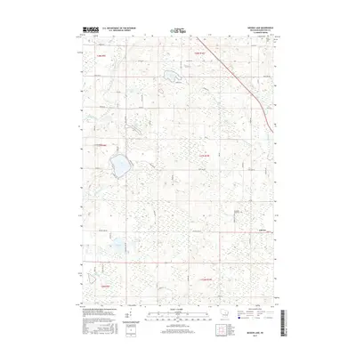
2015 Map of Mission Lake
USGS Topo · Published 2015About this map
Elderon anchors the eastern edge of this landscape, where the agricultural grid meets the dense network of kettle lakes and wetlands characteristic of the Wisconsin-Marathon County border. The namesake Mission Lake sits centrally alongside Little Lake, surrounded by a web of local roads such as Mission Lake Rd and Co Park Rd that suggest long-standing recreation and residential patterns. Further north, the Plover River winds through the western townships, passing near Rice Lake and Pike Lake, which is fed by Pike Lake Cr. The placement of Saint Francis Cem in the northeast and Evergreen Rest Cem further south provides important markers for genealogical research. Throughout the quadrangle, smaller waterways like Comet Cr and McVay Brook drain the undulating glacial terrain, illustrating the hydrologic complexity of this rural region.
Find a feature on this map
60 named features on this map. Tap any name to fly to it.
Don’t see what you’re looking for? This feature index may not catch every label — zoom into the map to look around manually.
Map Details
Editions of this 2015 Mission Lake Map
This is the sole edition of this map. No revisions or reprints were ever made.
Other maps of this area

1899 · Wausau
USGS Topo · 1:125,000

1902 · Wausau
USGS Topo · 1:125,000

1953 · Hatley
USGS Topo · 1:48,000

1954 · Wittenberg
USGS Topo · 1:48,000

1955 · Tigerton
USGS Topo · 1:48,000

1955 · Rosholt
USGS Topo · 1:48,000

1955 · Green Bay
USGS Topo · 1:250,000

1964 · Wittenberg
USGS Topo · 1:62,500

1964 · Hatley
USGS Topo · 1:62,500

1969 · Rosholt
USGS Topo · 1:24,000