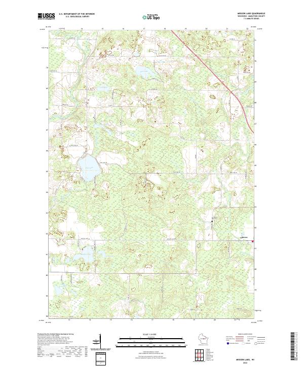
2022 Map of Mission Lake
USGS Topo · Published 2022About this map
Glacial topography and water dominate this Marathon County landscape, where the settlement of Elderon stands as a primary hub for the surrounding township. Numerous basins and kettles are filled by significant water bodies, including Pike Lake, Mission Lake, and the smaller Little Lake and Little Frog Lake to the southwest. The Plover River cuts through the northwest corner, while other drainages like McVay Brook and Comet Cr weave through the marshy lowland areas that define much of the terrain.
Find a feature on this map
55 named features on this map. Tap any name to fly to it.
Don’t see what you’re looking for? This feature index may not catch every label — zoom into the map to look around manually.
Map Details
Editions of this 2022 Mission Lake Map
This is the sole edition of this map. No revisions or reprints were ever made.
Other maps of this area

1899 · Wausau
USGS Topo · 1:125,000

1902 · Wausau
USGS Topo · 1:125,000

1953 · Hatley
USGS Topo · 1:48,000

1954 · Wittenberg
USGS Topo · 1:48,000

1955 · Tigerton
USGS Topo · 1:48,000

1955 · Rosholt
USGS Topo · 1:48,000

1955 · Green Bay
USGS Topo · 1:250,000

1964 · Wittenberg
USGS Topo · 1:62,500

1964 · Hatley
USGS Topo · 1:62,500

1969 · Rosholt
USGS Topo · 1:24,000