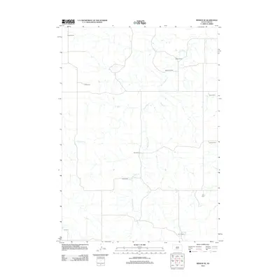
2012 Map of Mission NE
USGS Topo · Published 2012About this map
White Thunder Creek and its many small tributaries carve a complex drainage pattern across this portion of Todd County, defining the rural character of the Antelope Segment. This early twenty-first-century landscape is marked almost exclusively by the footprints of established ranching operations, reflecting the long-standing agricultural foundations of the region. Distinctive family-named holdings such as Bechtold Ranch and Medearis Ranch are connected by a sparse network of local roads that follow the high ground between creek beds. The drainage of Horse Head Creek in the west and the centralized Gifford Ranch provide anchor points for understanding property divisions and land use in this open South Dakota country. The map provides a clear record of these named homesteads, which serve as essential landmarks for local genealogy and land-use history.
Find a feature on this map
13 named features on this map. Tap any name to fly to it.
Don’t see what you’re looking for? This feature index may not catch every label — zoom into the map to look around manually.
Map Details
Editions of this 2012 Mission NE Map
This is the sole edition of this map. No revisions or reprints were ever made.
Other maps of this area

1955 · Martin
USGS Topo · 1:250,000

1958 · Martin
USGS Topo · 1:250,000

1969 · Mission NW
USGS Topo · 1:24,000

1969 · Mission
USGS Topo · 1:24,000

1982 · Mission NE
USGS Topo · 1:24,000

1982 · White River SE
USGS Topo · 1:24,000

1982 · Wood North
USGS Topo · 1:24,000

1982 · White River East
USGS Topo · 1:24,000

1982 · Okreek
USGS Topo · 1:25,000
1982 · Mission SE
USGS Topo · 1:24,000