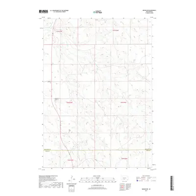
2017 Map of Mission NW
USGS Topo · Published 2017About this map
Sicangu Akicita Owicahe Veterans Cem and other sacred sites punctuate this landscape along the border of Mellette and Todd counties. The terrain is defined by a dense network of drainages including Horse Cr and Horse Head Cr, which carve through the plains toward the Little White River in the northwest. This 2017 survey reveals a rural landscape where the placement of cemeteries like Body of Christ Cem and Holy Family Cem offers essential clues for genealogists tracking local families in this part of South Dakota. Human activity is largely oriented around the north-south corridor of the highway and secondary routes like Bia Rd 9, which connect these isolated landmarks across the undulating prairie.
Find a feature on this map
15 named features on this map. Tap any name to fly to it.
Don’t see what you’re looking for? This feature index may not catch every label — zoom into the map to look around manually.
Map Details
Editions of this 2017 Mission NW Map
This is the sole edition of this map. No revisions or reprints were ever made.
Other maps of this area

1955 · Martin
USGS Topo · 1:250,000

1958 · Martin
USGS Topo · 1:250,000

1969 · Soldier Creek NE
USGS Topo · 1:24,000

1969 · Mission NW
USGS Topo · 1:24,000

1969 · Mission
USGS Topo · 1:24,000

1969 · Soldier Creek SE
USGS Topo · 1:24,000

1982 · Mission NE
USGS Topo · 1:24,000

1982 · White River SE
USGS Topo · 1:24,000

1982 · White River East
USGS Topo · 1:24,000
1982 · White River West
USGS Topo · 1:24,000
Featured Places
- Antelope Segment, SD
- Horse Creek Segment, SD
- Butte Creek Segment, SD
- Todd County, SD
- Mellette County, SD