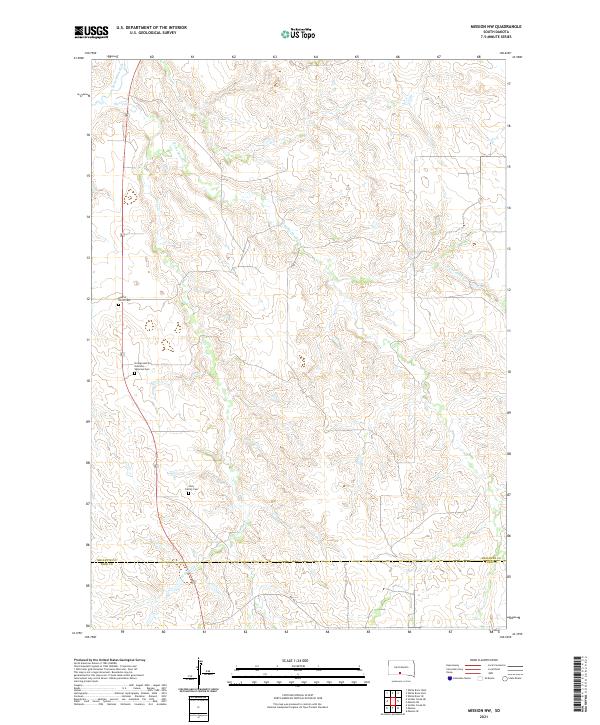
2021 Map of Mission NW
USGS Topo · Published 2021About this map
Little White River flows through the northwestern corner of this landscape, where the prairie begins its descent into the river valley. The region is defined by a network of seasonal drainages, including Horse Head Cr and Horse Cr, which carve intricate patterns across the terrain between the Mellette County and Todd County border. This area within the Rosebud Indian Reservation preserves significant cultural sites, notably the Sicangu Akicita Owicahe Veterans Cem, alongside the Body of Christ Cem and Holy Family Cem. The map reflects a rural landscape where transportation is anchored by routes like Bia Rd 9, providing a detailed look at the geographical relationship between local watercourses and established community landmarks.
Find a feature on this map
15 named features on this map. Tap any name to fly to it.
Don’t see what you’re looking for? This feature index may not catch every label — zoom into the map to look around manually.
Map Details
Editions of this 2021 Mission NW Map
This is the sole edition of this map. No revisions or reprints were ever made.
Other maps of this area

1955 · Martin
USGS Topo · 1:250,000

1958 · Martin
USGS Topo · 1:250,000

1969 · Soldier Creek NE
USGS Topo · 1:24,000

1969 · Mission NW
USGS Topo · 1:24,000

1969 · Mission
USGS Topo · 1:24,000

1969 · Soldier Creek SE
USGS Topo · 1:24,000

1982 · Mission NE
USGS Topo · 1:24,000

1982 · White River SE
USGS Topo · 1:24,000

1982 · White River East
USGS Topo · 1:24,000
1982 · White River West
USGS Topo · 1:24,000
Featured Places
- Horse Creek Segment, SD
- Antelope Segment, SD
- Butte Creek Segment, SD
- Todd County, SD
- Mellette County, SD