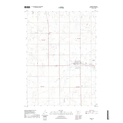
2017 Map of Mission
USGS Topo · Published 2017About this map
Mission serves as a primary settlement on this Todd County landscape, situated near the headwaters of several drainage systems including W Br Horse Cr. The area is characterized by its tribal and community infrastructure, particularly evident in the concentration of historical burial sites. Researchers focusing on local genealogy will find several distinct locations, such as the Indian Mission Cem to the north and a cluster of denominational sites near the town center, including Zions Lutheran Cem, Saint Thomas Cem, and Trinity Cem. To the east, the community of Antelope marks the transition toward the open plains of the Rosebud region. The layout of the roads and sections reflects the organized land divisions within this part of South Dakota, providing a clear view of the rural and civic development established by the early 21st century.
Find a feature on this map
7 named features on this map. Tap any name to fly to it.
Don’t see what you’re looking for? This feature index may not catch every label — zoom into the map to look around manually.
Map Details
Editions of this 2017 Mission Map
This is the sole edition of this map. No revisions or reprints were ever made.
Other maps of this area

1955 · Martin
USGS Topo · 1:250,000

1958 · Martin
USGS Topo · 1:250,000

1969 · Soldier Creek NE
USGS Topo · 1:24,000

1969 · Mission NW
USGS Topo · 1:24,000

1969 · Mission
USGS Topo · 1:24,000

1969 · Soldier Creek SE
USGS Topo · 1:24,000

1969 · Olsonville NW
USGS Topo · 1:24,000

1969 · Rosebud
USGS Topo · 1:24,000

1982 · Mission NE
USGS Topo · 1:24,000

1982 · Olsonville
USGS Topo · 1:24,000
Featured Places
- Rosebud, SD
- Mission, Antelope Segment
- Antelope Segment, SD
- Antelope, Antelope Segment
- Antelope Development Area, Antelope Segment