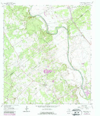
1963 Map of Mission Valley
USGS Topo · Published 1987About this map
The Guadalupe River meanders across this landscape on the De Witt and Victoria County line during the 1960s, a period defined by extensive resource extraction and rural development. The area is heavily marked by the Texas energy sector, with the Thomaston Gas Field, Arneckeville Gas Field, and Mission Valley Gas Field distributed across the terrain. These industrial features contrast with the established community structures at Mission Valley, where the Mission Valley Church and Guadalupe Cemetery serve as local anchors. Transportation and utility networks are prominent, including the Southern Pacific railroad corridor and numerous Gravel Pits. Local roads like Albrecht Road and Arnold Road provide access to family-named landmarks and historical sites such as Camp de Leon, reflecting the region's blended heritage of ranching, rail, and petroleum production.
Find a feature on this map
34 named features on this map. Tap any name to fly to it.
Don’t see what you’re looking for? This feature index may not catch every label — zoom into the map to look around manually.
Map Details
Editions of this 1963 Mission Valley Map
2 editions found
Other maps of this area

1953 · Beeville
USGS Topo · 1:250,000

1953 · Seguin
USGS Topo · 1:250,000

1956 · Beeville
USGS Topo · 1:250,000

1958 · Seguin
USGS Topo · 1:250,000

1960 · Beeville
USGS Topo · 1:250,000

1960 · Cuero
USGS Topo · 1:24,000

1962 · Verhelle
USGS Topo · 1:24,000

1963 · Fordtran
USGS Topo · 1:24,000

1963 · Meyersville
USGS Topo · 1:24,000

1963 · Nursery
USGS Topo · 1:24,000