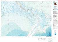
1983 Map of Mississippi River Delta
USGS Topo · Published 1983About this map
Plaquemines Parish and the terminating reaches of the Mississippi River are charted in this 1983 topographic-bathymetric survey, capturing the fragile transition where Louisiana's wetlands meet the Gulf of Mexico. The map details the ribbon of settlements that follow the river's course, including Port Sulphur, Buras, and Triumph, terminating at the river-pilot community of Pilottown. The landscape is dominated by complex hydrology, from the broad expanse of Lake Grande Ecaille to the network of channels including Southwest Pass and Main Pass. Large-scale conservation efforts are evident through the Delta National Wildlife Refuge and the Pass a Loutre State Waterfowl Management Area. This mapping period illustrates the intense industrial and navigational importance of the delta, noting numerous Spoil Areas and offshore mineral lease blocks like the West Delta Area.
Find a feature on this map
52 named features on this map. Tap any name to fly to it.
Don’t see what you’re looking for? This feature index may not catch every label — zoom into the map to look around manually.
Map Details
Editions of this 1983 Mississippi River Delta Map
2 editions found
Other maps of this area

1891 · Pointe a La Hache
USGS Topo · 1:62,500

1892 · Barataria
USGS Topo · 1:62,500

1892 · Cheniere Caminada
USGS Topo · 1:62,500

1892 · Quarantine
USGS Topo · 1:62,500

1892 · Creole
USGS Topo · 1:62,500

1892 · Pointe a La Hache
USGS Topo · 1:62,500

1893 · East Delta
USGS Topo · 1:62,500

1893 · La Fortuna
USGS Topo · 1:62,500

1893 · Forts
USGS Topo · 1:62,500

1893 · Fort Livingston
USGS Topo · 1:62,500