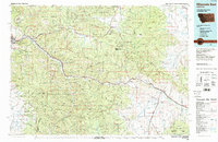
1984 Map of Missoula East
USGS Topo · Published 1984About this map
The confluence of the Clark Fork and Blackfoot River shapes the development of this Montana corridor, where the city of Missoula serves as a major hub for education and industry. At the western edge, the University of Montana campus anchors the urban center, while small neighboring settlements like East Missoula, Milltown, and Bonner trace the river valley eastward. The landscape is defined by the sharp transition from the valley floor to the high elevations of the Garnet Range and the Sapphire Mountains, where historical extraction sites such as the Copper Cliff Mine and Whaley Mine reflect the region's mineral-rich history.
Find a feature on this map
57 named features on this map. Tap any name to fly to it.
Don’t see what you’re looking for? This feature index may not catch every label — zoom into the map to look around manually.
Map Details
Editions of this 1984 Missoula East Map
This is the sole edition of this map. No revisions or reprints were ever made.
Other maps of this area

1889 · Helena
USGS Topo · 1:250,000

1893 · Helena
USGS Topo · 1:250,000

1899 · Helena
USGS Topo · 1:250,000

1901 · Hamilton
USGS Topo · 1:125,000

1902 · Ovando
USGS Topo · 1:125,000

1903 · Coopers Lake
USGS Topo · 1:125,000

1903 · Bonner
USGS Topo · 1:125,000

1903 · Helena
USGS Topo · 1:250,000

1905 · Ovando
USGS Topo · 1:125,000

1908 · Philipsburg
USGS Topo · 1:125,000