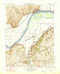
1947 Map of Missouri City
USGS Topo · Published 1947About this map
Missouri River hydrology and rail transport dominate this 1940s landscape, where the Clay and Jackson county line follows the winding river channel. The northern bank is anchored by Missouri City, a point where the Wabash Railroad skirts the edge of the Fishing River bottoms. South of the river, the Atchison Topeka and Santa Fe Railway cuts through Atherton, connecting the low-lying Missouri City Bend to the industrial corridor. This era shows a densely settled agricultural region defined by its reliance on small, local hubs, evidenced by a high concentration of country schools such as Hunt Sch, Nebo Sch, and Blue Valley Sch. The presence of the McCune Home and landmarks like Nebo Hill reflect the specific social and topographic character of the river bluffs just before post-war suburbanization altered the rural township patterns.
Find a feature on this map
34 named features on this map. Tap any name to fly to it.
Don’t see what you’re looking for? This feature index may not catch every label — zoom into the map to look around manually.
Map Details
Editions of this 1947 Missouri City Map
2 editions found
Other maps of this area

1894 · Independence
USGS Topo · 1:125,000

1933 · Blue Springs
USGS Topo · 1:24,000

1934 · Oak Grove
USGS Topo · 1:24,000

1934 · Independence
USGS Topo · 1:24,000

1935 · Buckner
USGS Topo · 1:24,000

1935 · Missouri City
USGS Topo · 1:24,000

1935 · Liberty
USGS Topo · 1:24,000

1936 · Kearney
USGS Topo · 1:48,000

1940 · Liberty
USGS Topo · 1:31,680
1940 · Independence
USGS Topo · 1:31,680