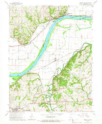
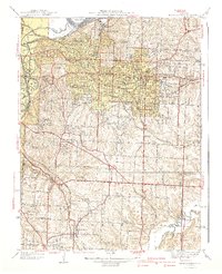
1965 Map of Missouri City
USGS Topo · Published 1966About this map
Missouri City sits prominently along the north bank of the Missouri River, serving as a focal point where industrial and natural landscapes converge in the mid-1960s. The area is defined by a dense network of major transport lines, including the Norfolk and Western Railway and the Santa Fe Trail, which skirt the river's path and the rugged bluffs of Nebo Hill. Further south, the landscape shifts toward the historic grounds of Fort Osage and the community of Blue Mills.
Find a feature on this map
48 named features on this map. Tap any name to fly to it.
Don’t see what you’re looking for? This feature index may not catch every label — zoom into the map to look around manually.
Map Details
Editions of this 1965 Missouri City Map
4 editions found
Other maps of this area

1894 · Independence
USGS Topo · 1:125,000

1933 · Blue Springs
USGS Topo · 1:24,000

1934 · Oak Grove
USGS Topo · 1:24,000

1934 · Independence
USGS Topo · 1:24,000

1935 · Buckner
USGS Topo · 1:24,000

1935 · Missouri City
USGS Topo · 1:24,000

1935 · Liberty
USGS Topo · 1:24,000

1936 · Kearney
USGS Topo · 1:48,000

1940 · Liberty
USGS Topo · 1:31,680
1940 · Independence
USGS Topo · 1:31,680