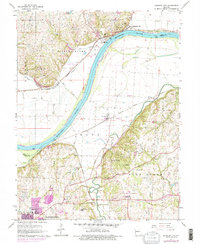
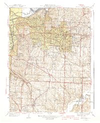
1965 Map of Missouri City
USGS Topo · Published 1976About this map
Missouri River meanders define the border between Clay and Jackson Counties, where the north bank is dominated by Missouri City and the south by agricultural flats near Atherton. Industrial and transportation infrastructure is prominent, with the Norfolk and Western and Missouri Pacific railroads following the river's curves. To the south, the Independence urban area begins to push into the hills of Fort Osage, visible in the purple revision tinting. Genealogists can find numerous family-named burial sites including Rice Cem, Chiles Cem, and Drake Cem. Significant local landmarks range from the institutional McCune Home For Boys and Fort Osage High Sch to extractive sites like the mine tunnels and quarries near Nebo Hill.
Find a feature on this map
45 named features on this map. Tap any name to fly to it.
Don’t see what you’re looking for? This feature index may not catch every label — zoom into the map to look around manually.
Map Details
Editions of this 1965 Missouri City Map
4 editions found
Other maps of this area

1894 · Independence
USGS Topo · 1:125,000

1933 · Blue Springs
USGS Topo · 1:24,000

1934 · Oak Grove
USGS Topo · 1:24,000

1934 · Independence
USGS Topo · 1:24,000

1935 · Buckner
USGS Topo · 1:24,000

1935 · Missouri City
USGS Topo · 1:24,000

1935 · Liberty
USGS Topo · 1:24,000

1936 · Kearney
USGS Topo · 1:48,000

1940 · Liberty
USGS Topo · 1:31,680
1940 · Independence
USGS Topo · 1:31,680