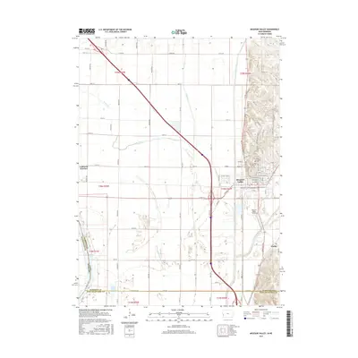
2015 Map of Missouri Valley
USGS Topo · Published 2015About this map
Missouri Valley serves as the focal point of this Harrison County landscape, where the flat Missouri River floodplain meets the rising elevation of the Loess Hills. This transition in topography is marked by several small settlements and rural crossroads, including California Junction and Findley. The hydrology of the region is complex, defined by engineered drainage and natural remnants like Fish Lake, Nobles Lake, and the meandering path of the Boyer River. Extensive water management is evident through features such as Wilson Ditch and the channelized Allen Creek, which work to manage the alluvial soils of the valley floor.
Find a feature on this map
56 named features on this map. Tap any name to fly to it.
Don’t see what you’re looking for? This feature index may not catch every label — zoom into the map to look around manually.
Map Details
Editions of this 2015 Missouri Valley Map
This is the sole edition of this map. No revisions or reprints were ever made.
Other maps of this area

1893 · Omaha
USGS Topo · 1:62,500

1893 · Fremont
USGS Topo · 1:125,000

1896 · Fremont
USGS Topo · 1:125,000

1954 · Omaha
USGS Topo · 1:250,000

1955 · Fremont
USGS Topo · 1:250,000

1957 · Fremont
USGS Topo · 1:250,000

1957 · Omaha
USGS Topo · 1:250,000

1957 · Loveland
USGS Topo · 1:24,000

1957 · Honey Creek
USGS Topo · 1:24,000

1958 · Omaha
USGS Topo · 1:250,000