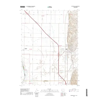
2018 Map of Missouri Valley
USGS Topo · Published 2018About this map
Missouri Valley serves as the primary hub on this sheet, where the intricate street grid meets the edge of the distinctive Loess Hills Trl formation. The landscape is defined by the confluence of the Boyer River and several managed waterways like Wilson Ditch and Willow Creek, which navigate the flat bottomlands near the border with Nebraska. This 2018 survey reveals the persistent agricultural and transport-based character of the region, from the smaller settlements of California Junction and Findley to the infrastructure of the Missouri Valley Airport. For those researching local heritage, several significant burial sites are meticulously recorded along the bluffs, including Old Frazier Cem, Mount Carmel Cem, and Rose Hill Cem, providing clear spatial context for historical genealogies. The western edge of the quadrangle reaches toward the Washington County line and the waters of De Soto Lake, highlighting the area's complex hydrography and jurisdictional boundaries.
Find a feature on this map
82 named features on this map. Tap any name to fly to it.
Don’t see what you’re looking for? This feature index may not catch every label — zoom into the map to look around manually.
Map Details
Editions of this 2018 Missouri Valley Map
This is the sole edition of this map. No revisions or reprints were ever made.
Other maps of this area

1893 · Omaha
USGS Topo · 1:62,500

1893 · Fremont
USGS Topo · 1:125,000

1896 · Fremont
USGS Topo · 1:125,000

1954 · Omaha
USGS Topo · 1:250,000

1955 · Fremont
USGS Topo · 1:250,000

1957 · Fremont
USGS Topo · 1:250,000

1957 · Omaha
USGS Topo · 1:250,000

1957 · Loveland
USGS Topo · 1:24,000

1957 · Honey Creek
USGS Topo · 1:24,000

1958 · Omaha
USGS Topo · 1:250,000