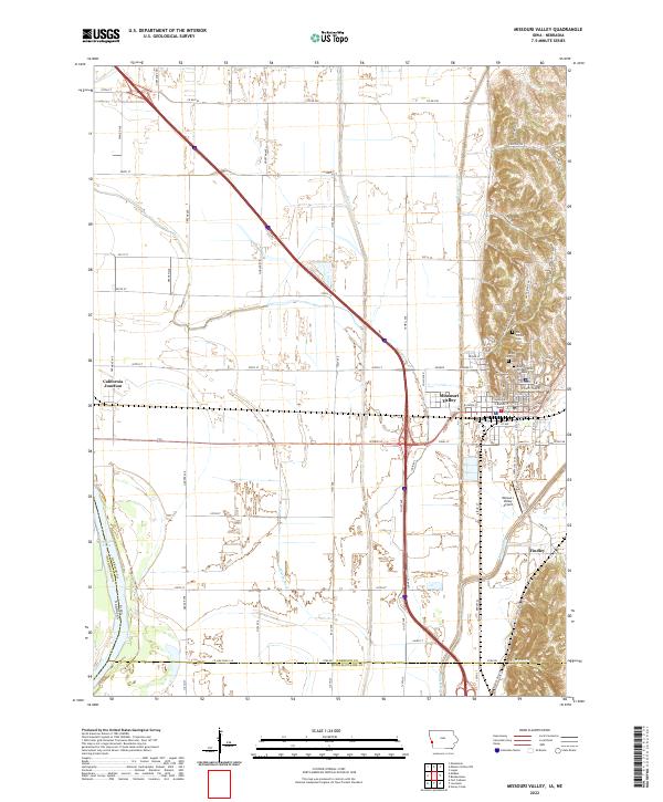
2022 Map of Missouri Valley
USGS Topo · Published 2022About this map
The Missouri River floodplain and the striking western edge of the Loess Hills define this Harrison County landscape. The town of Missouri Valley sits at the foot of these steep bluffs, which are home to several historic burial sites including Mount Carmel Cem, Old Frazier Cem, and the larger Rose Hill Memorial Gardens. This modern survey illustrates the complex water management of the lowlands, where the Boyer River and Willow Creek navigate a grid of engineered drainage features like the Wilson Ditch.
Find a feature on this map
52 named features on this map. Tap any name to fly to it.
Don’t see what you’re looking for? This feature index may not catch every label — zoom into the map to look around manually.
Map Details
Editions of this 2022 Missouri Valley Map
This is the sole edition of this map. No revisions or reprints were ever made.
Other maps of this area

1893 · Omaha
USGS Topo · 1:62,500

1893 · Fremont
USGS Topo · 1:125,000

1896 · Fremont
USGS Topo · 1:125,000

1954 · Omaha
USGS Topo · 1:250,000

1955 · Fremont
USGS Topo · 1:250,000

1957 · Fremont
USGS Topo · 1:250,000

1957 · Omaha
USGS Topo · 1:250,000

1957 · Loveland
USGS Topo · 1:24,000

1957 · Honey Creek
USGS Topo · 1:24,000

1958 · Omaha
USGS Topo · 1:250,000