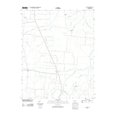
2010 Map of Miston
USGS Topo · Published 2010About this map
Miston Post Office and Bogota Post Office serve as the primary navigational anchors in this rural West Tennessee landscape, where the flatlands meet the meandering Obion River. The hydrology of the region is a defining characteristic, dominated by the Running Reelfoot Bayou and various drainage creeks like Daugherty Creek and Aldridge Creek. The terrain reveals local nomenclature for small depressions and valleys, such as Booger Den Hollow and Inman Hollow, which break the agricultural grid.
Find a feature on this map
55 named features on this map. Tap any name to fly to it.
Don’t see what you’re looking for? This feature index may not catch every label — zoom into the map to look around manually.
Map Details
Editions of this 2010 Miston Map
This is the sole edition of this map. No revisions or reprints were ever made.
Other maps of this area

1925 · Reelfoot Lake
USGS Topo · 1:62,500

1939 · Reelfoot Lake
USGS Topo · 1:62,500

1939 · Portageville
USGS Topo · 1:62,500

1939 · Dyersburg
USGS Topo · 1:62,500

1939 · Caruthersville
USGS Topo · 1:62,500

1951 · Caruthersville
USGS Topo · 1:62,500

1952 · Newbern
USGS Topo · 1:24,000

1952 · Lane
USGS Topo · 1:24,000

1952 · Dyersburg
USGS Topo · 1:24,000

1952 · Miston
USGS Topo · 1:24,000