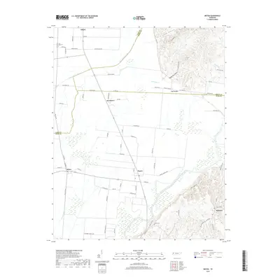
2019 Map of Miston
USGS Topo · Published 2019About this map
Ridgely anchors the northwest corner of this West Tennessee landscape, where the flat, fertile bottomlands of the Mississippi River floodplain meet the rising bluffs of the east. The course of the Obion River dominates the southern half of the map, carving through wetlands and low-lying woods as it flows toward its eventual confluence with the Mississippi. This area is defined by a dense network of country roads named for local families and landmarks, such as Horn Ridge Rd and Chandlers Mill Rd, reflecting a long history of agricultural settlement. Small communities like Bogota, Miston, and Broadmoor are scattered across the plain, while Millsfield sits tucked against the base of the loess hills. Local history is preserved in sites like Horn Ridge Cem and Bledsoe Cem, while distinctive topographic features like Inman Hollow and Booger Den Hollow provide a sharp contrast to the level fields along the Running Reelfoot Bayou.
Find a feature on this map
49 named features on this map. Tap any name to fly to it.
Don’t see what you’re looking for? This feature index may not catch every label — zoom into the map to look around manually.
Map Details
Editions of this 2019 Miston Map
This is the sole edition of this map. No revisions or reprints were ever made.
Other maps of this area

1925 · Reelfoot Lake
USGS Topo · 1:62,500

1939 · Reelfoot Lake
USGS Topo · 1:62,500

1939 · Portageville
USGS Topo · 1:62,500

1939 · Dyersburg
USGS Topo · 1:62,500

1939 · Caruthersville
USGS Topo · 1:62,500

1951 · Caruthersville
USGS Topo · 1:62,500

1952 · Newbern
USGS Topo · 1:24,000

1952 · Lane
USGS Topo · 1:24,000

1952 · Dyersburg
USGS Topo · 1:24,000

1952 · Miston
USGS Topo · 1:24,000