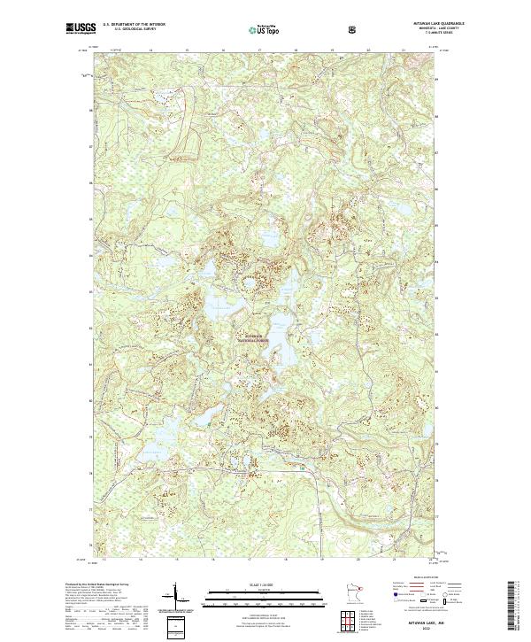
2022 Map of Mitawan Lake
USGS Topo · Published 2022About this map
The Superior National Forest encompasses this wilderness region of northern Minnesota, dominated by a dense network of glacial lakes and river systems. Central to the landscape is Mitawan Lake, surrounded by smaller bodies such as Kitigan Lake and Acker Lake. The Little Isabella River snakes through the southern and western portions of the quadrangle, serving as a primary drainage for the area's numerous bogs and creeks, including Sphagnum Cr and Mitawan Cr. A complex grid of forest roads and spurs, such as the Tomahawk and Jackpine routes, reveals the intensive management and logging access required in this timber-rich environment. To the southwest, Lake Gegoka sits near Minnesota Highway 1, while more remote features like Steamhaul Lake and Hogstrom Lake are accessible only by specialized trails like the Steamhaul Lake Road.
Find a feature on this map
56 named features on this map. Tap any name to fly to it.
Don’t see what you’re looking for? This feature index may not catch every label — zoom into the map to look around manually.
Map Details
Editions of this 2022 Mitawan Lake Map
This is the sole edition of this map. No revisions or reprints were ever made.
Other maps of this area

1954 · Greenwood Lake
USGS Topo · 1:62,500

1954 · Two Harbors
USGS Topo · 1:250,000

1955 · Isabella
USGS Topo · 1:62,500

1957 · Two Harbors
USGS Topo · 1:250,000

1957 · Gabbro Lake
USGS Topo · 1:62,500

1958 · Two Harbors
USGS Topo · 1:250,000

1964 · Two Harbors
USGS Topo · 1:250,000
1981 · Gabbro Lake
USGS Topo · 1:24,000
1981 · Isabella
USGS Topo · 1:24,000
1981 · Slate Lake East
USGS Topo · 1:24,000