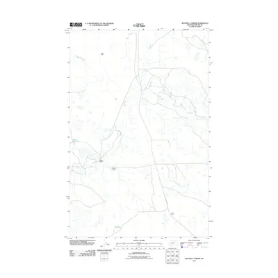
2011 Map of Mitchell Corner
USGS Topo · Published 2011About this map
Nelson Reservoir and its associated drainage systems define this section of Phillips County, Montana, as it appeared in the early 2010s. The landscape is shaped by the winding course of Beaver Creek, which flows through a region marked by numerous small water bodies and seasonal drainages. Local landmarks include Mitchell Corner in the southeast and the wide expanse of Alkali Flat to the north, illustrating the semi-arid character of the high plains.
Find a feature on this map
9 named features on this map. Tap any name to fly to it.
Don’t see what you’re looking for? This feature index may not catch every label — zoom into the map to look around manually.
Map Details
Editions of this 2011 Mitchell Corner Map
This is the sole edition of this map. No revisions or reprints were ever made.
Other maps of this area

1954 · Jordan
USGS Topo · 1:250,000

1954 · Glasgow
USGS Topo · 1:250,000

1956 · Jordan
USGS Topo · 1:250,000

1957 · Glasgow
USGS Topo · 1:250,000

1958 · Glasgow
USGS Topo · 1:250,000

1958 · Jordan
USGS Topo · 1:250,000

1964 · Jordan
USGS Topo · 1:250,000

1965 · Whitcomb Lake
USGS Topo · 1:24,000

1965 · Sheep Coulee
USGS Topo · 1:24,000
1965 · Emond Ranch
USGS Topo · 1:24,000