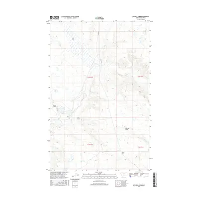
2017 Map of Mitchell Corner
USGS Topo · Published 2017About this map
Mitchell Corner anchors this section of Phillips County, Montana, situated within a high-plains landscape defined by seasonal drainages and drainage basins. The geography is dominated by a complex network of coulees, including Nelson Coulee, Camp Coulee, and the expansive Seven Mile Coulee, which channel water toward intermittent streams like Beaver Cr and Little Sevenmile Cr. The presence of Alkali Flat in the northern reach and the Puckett Reservoir to the south illustrates the area's reliance on water management and the natural salinity of the soil. Sun Prairie Rd provides the primary north-south transit corridor through this remote rangeland, where the Public Land Survey System grids out Township 26 and 27 North across the open terrain.
Find a feature on this map
13 named features on this map. Tap any name to fly to it.
Don’t see what you’re looking for? This feature index may not catch every label — zoom into the map to look around manually.
Map Details
Editions of this 2017 Mitchell Corner Map
This is the sole edition of this map. No revisions or reprints were ever made.
Other maps of this area

1954 · Jordan
USGS Topo · 1:250,000

1954 · Glasgow
USGS Topo · 1:250,000

1956 · Jordan
USGS Topo · 1:250,000

1957 · Glasgow
USGS Topo · 1:250,000

1958 · Glasgow
USGS Topo · 1:250,000

1958 · Jordan
USGS Topo · 1:250,000

1964 · Jordan
USGS Topo · 1:250,000

1965 · Whitcomb Lake
USGS Topo · 1:24,000

1965 · Sheep Coulee
USGS Topo · 1:24,000
1965 · Emond Ranch
USGS Topo · 1:24,000