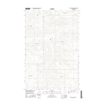
2017 Map of Mitchell Crossing
USGS Topo · Published 2017About this map
Mitchell Crossing serves as the focal point for this section of Fergus County, where the winding course of Armells Cr cuts through the high plains landscape. The area is defined by its topographic extremes, from the heights of Indian Butte and the elongated Knox Ridge to the depressions of Fargo Coulee. Transportation across this expansive ranching country relies on a sparse network of thoroughfares, including Knox Ridge Rd and the northern Middle-Two Calf Rd. A notable modern addition to this landscape is the Knox Ridge Airport, situated on the plateau near the northern edge of the ridge. Water management in this semi-arid environment is evidenced by the Flat Top Reservoir, which sits near the township lines of T22N R23E. This 2017 survey illustrates the persistence of traditional land divisions and the strategic placement of infrastructure in a region where geography dictates movement.
Find a feature on this map
15 named features on this map. Tap any name to fly to it.
Don’t see what you’re looking for? This feature index may not catch every label — zoom into the map to look around manually.
Map Details
Editions of this 2017 Mitchell Crossing Map
This is the sole edition of this map. No revisions or reprints were ever made.
Other maps of this area

1943 · Landusky
USGS Topo · 1:125,000

1954 · Hessler Ridge
USGS Topo · 1:24,000

1954 · Baker Monument
USGS Topo · 1:24,000

1954 · Bell Ridge West
USGS Topo · 1:24,000

1954 · Grand Island
USGS Topo · 1:24,000

1954 · Lewistown
USGS Topo · 1:250,000

1959 · Lewistown
USGS Topo · 1:250,000

1984 · Zortman
USGS Topo · 1:100,000

1985 · Griffee Coulee
USGS Topo · 1:24,000

1985 · Thompson Coulee
USGS Topo · 1:24,000