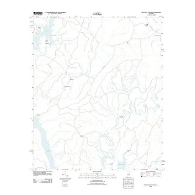
2011 Map of Mitchell Dam NW
USGS Topo · Published 2011About this map
Lay Lake and Mitchell Lake dominate the western and southern edges of this Coosa County landscape, where the Coosa River's reach supports a network of landings and recreation sites. The terrain is marked by numerous watercourses, including the winding Weogufka Creek and the long reach of Clay Creek, which flows past the settlement at Quinsey. The map reveals a deeply localized history through its scattered burial grounds, such as Duke Cemetery in the northeast and Ham Lewis Cemetery further south, providing essential points of reference for genealogical research.
Find a feature on this map
30 named features on this map. Tap any name to fly to it.
Don’t see what you’re looking for? This feature index may not catch every label — zoom into the map to look around manually.
Map Details
Editions of this 2011 Mitchell Dam NW Map
This is the sole edition of this map. No revisions or reprints were ever made.
Other maps of this area

1890 · Bessemer
USGS Topo · 1:125,000

1890 · Talladega
USGS Topo · 1:125,000

1891 · Clanton
USGS Topo · 1:125,000

1892 · Talladega
USGS Topo · 1:125,000

1892 · Bessemer
USGS Topo · 1:125,000

1901 · Wetumpka
USGS Topo · 1:125,000

1903 · Wetumpka
USGS Topo · 1:125,000

1909 · Columbiana
USGS Topo · 1:62,500

1911 · Columbiana
USGS Topo · 1:62,500

1915 · Gantts Quarry
USGS Topo · 1:48,000